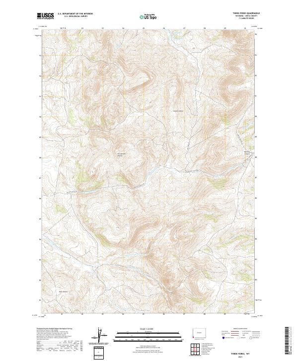
2021 Map of Three Forks
USGS Topo · Published 2021About this map
The headwaters of Whitney Canyon Cr and the complex drainage systems of the Fowkes Canyon forks define this high-elevation landscape in Uinta County. Significant topographical features like Acocks Canyon and Christensen Hollow break the terrain, while reliable water sources such as School Section Spring and Grave Spring suggest the importance of the land for livestock or seasonal migration. The map detail highlights a network of remote ranching roads, including Whitney Canyon Rd and Salt Creek Rd, which provide access to these isolated hollows.
Find a feature on this map
25 named features on this map. Tap any name to fly to it.
Don’t see what you’re looking for? This feature index may not catch every label — zoom into the map to look around manually.
Map Details
Editions of this 2021 Three Forks Map
This is the sole edition of this map. No revisions or reprints were ever made.
Other maps of this area

1912 · Randolph
USGS Topo · 1:125,000

1954 · Ogden
USGS Topo · 1:250,000

1958 · Ogden
USGS Topo · 1:250,000

1960 · Ogden
USGS Topo · 1:250,000

1962 · Sawtooth Mountain
USGS Topo · 1:24,000

1962 · Bell Butte
USGS Topo · 1:24,000

1965 · Evanston
USGS Topo · 1:24,000

1965 · Little Dee Creek
USGS Topo · 1:24,000

1965 · Guild Hollow
USGS Topo · 1:24,000

1965 · Three Forks
USGS Topo · 1:24,000