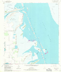
1954 Map of Three Islands
USGS Topo · Published 1971About this map
Laguna Atascosa National Wildlife Refuge dominates the western shoreline of the Laguna Madre in this mid-century survey of the South Texas coast. The landscape is defined by the shifting interface of water and land, characterized by vast stretches of Sand and Mud and the intricate channels of the Intracoastal Waterway. Notable landmarks along the refuge boundary include Red Head Bluff and the winding Resaca de los Cuates, a former river channel that speaks to the region's complex hydrological history.
Find a feature on this map
37 named features on this map. Tap any name to fly to it.
Don’t see what you’re looking for? This feature index may not catch every label — zoom into the map to look around manually.
Map Details
Editions of this 1954 Three Islands Map
3 editions found
Other maps of this area

1929 · La Coma
USGS Topo · 1:24,000

1929 · Buena Vista
USGS Topo · 1:24,000

1930 · Padre Island No. 1
USGS Topo · 1:24,000

1930 · La Leona
USGS Topo · 1:24,000

1930 · Padre Island No. 2
USGS Topo · 1:24,000

1930 · Laguna Atascosa
USGS Topo · 1:24,000

1934 · La Coma
USGS Topo · 1:31,680

1935 · Padre Island No 1
USGS Topo · 1:31,680

1935 · Padre Island NO. 2
USGS Topo · 1:31,680

1935 · Buena Vista
USGS Topo · 1:31,680