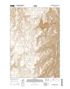
2014 Map of Three Lakes Country
USGS Topo · Published 2014About this map
Three Lake Country occupies a high-altitude plateau in Wallowa County, where the landscape is defined by its seasonal wetlands and complex drainage systems. Small bodies of water such as Sprudy Lake, Marshman Lake, and Nuxall Lake are clustered together on this high bench, providing a distinct contrast to the deep incisions of Box Canyon and Wolf Canyon to the east. The area's topography is marked by significant elevation changes, with Hayden Butte rising above the northern reaches of Hayden Lake. This 2014 survey documents the isolated road network of this ranching and grazing district, centered around Zumwalt Rd and Three Lake Ln. Numerous tributaries, including North Fork Lightning Cr and the Middle Fork Crow Cr, carve through the terrain, illustrating the intricate watershed that feeds the larger canyon systems in this part of Northeast Oregon.
Find a feature on this map
22 named features on this map. Tap any name to fly to it.
Don’t see what you’re looking for? This feature index may not catch every label — zoom into the map to look around manually.
Map Details
Editions of this 2014 Three Lakes Country Map
This is the sole edition of this map. No revisions or reprints were ever made.
Other maps of this area

1954 · Imnaha
USGS Topo · 1:62,500

1954 · Harl Butte
USGS Topo · 1:62,500

1955 · Grangeville
USGS Topo · 1:250,000

1957 · Joseph
USGS Topo · 1:62,500

1957 · Elk Mountain
USGS Topo · 1:62,500

1959 · Grangeville
USGS Topo · 1:250,000

1980 · Grangeville
USGS Topo · 1:100,000

1982 · Wallowa
USGS Topo · 1:100,000

1986 · Enterprise
USGS Topo · 1:100,000

1987 · Riggins
USGS Topo · 1:100,000