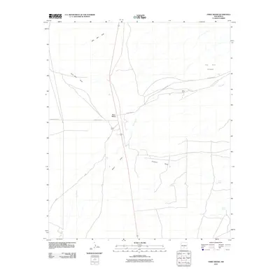
2010 Map of Three Rivers
USGS Topo · Published 2010About this map
Three Rivers Petroglyph stands as a prominent cultural landmark in this high-desert region of Otero County, where the landscape is defined by a network of drainage channels and isolated ranching outposts. The settlement of Three Rivers sits near the junction of major local thoroughfares like Three Rivers Rd and WSMR S Route 311, serving as a focal point for the surrounding cattle country. Ranching life is documented through named sites such as Falls Ranch and Hatchet Ranch, which rely on the scarce water resources of the basin. The complex hydrology of the area is mapped through numerous ephemeral watercourses, including New Well Draw, Sand Well Draw, and Crawford Draw, while localized water sources like Aguilar Spring and Crosby Spring provide critical points of relief in the arid terrain.
Find a feature on this map
13 named features on this map. Tap any name to fly to it.
Don’t see what you’re looking for? This feature index may not catch every label — zoom into the map to look around manually.
Map Details
Editions of this 2010 Three Rivers Map
This is the sole edition of this map. No revisions or reprints were ever made.
Other maps of this area

1916 · Tularosa
USGS Topo · 1:125,000

1947 · Three Rivers
USGS Topo · 1:62,500

1948 · Tularosa
USGS Topo · 1:62,500

1950 · Three Rivers
USGS Topo · 1:24,000

1950 · Oscura
USGS Topo · 1:24,000

1950 · Sierra Blanca Peak
USGS Topo · 1:62,500

1950 · Mescalero
USGS Topo · 1:62,500

1954 · Tularosa
USGS Topo · 1:250,000

1955 · Roswell
USGS Topo · 1:250,000

1958 · Roswell
USGS Topo · 1:250,000