Loading...
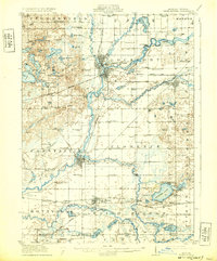
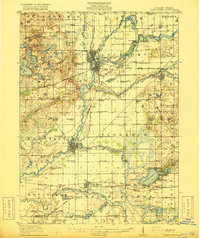
Loading map...1916 Map of Three Rivers
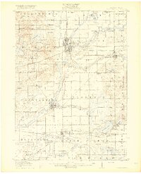
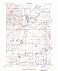
USGS Topo · Published 1932About this map
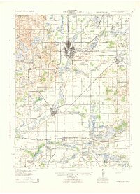
Three Rivers sits at the hydrological heart of this landscape, where the Portage River, Rocky River, and St Joseph River converge. This 1914 survey captures a moment when the river-and-rail economy was peaking, marked by the Sturgis Power Dam and the heavy presence of the New York Central railroad. The map reveals an incredible density of rural social infrastructure, with dozens of family-named schools such as Johnnycake School and Peck Academy dotting the countryside.
Find a feature on this map
94 named features on this map. Tap any name to fly to it.
Don’t see what you’re looking for? This feature index may not catch every label — zoom into the map to look around manually.
Map Details
Date Portrayed1916
Date Published1932
PublisherU.S. Geological Survey
Map TypeTopographic
Scale1:62,500
Physical Dimensions16.5 x 19.9 inches
Editions of this 1916 Three Rivers Map
3 editions found
Historical Maps of Three Rivers Through Time
3 maps found
Featured Locations
- Three Rivers, MI
- Constantine, Constantine Township
- White Pigeon, White Pigeon Township
- Fabius, Fabius Township
- Centreville, Nottawa Township
Source Details
SourceU.S. Geological Survey
CopyrightPublic Domain