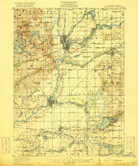
1916 Map of Three Rivers
USGS Topo · Published 1916About this map
St Joseph River and its major tributaries, including the Rocky River, Portage River, and Prairie River, converge in this early 20th-century survey of St. Joseph County. The landscape is defined by its complex hydrography, featuring the Sturgis Power Dam and a dense network of glacial lakes like Klinger Lake and Corey Lake. The New York Central railroad lines weave through established centers like Three Rivers and Centerville, illustrating a region transitioning from its pioneer agricultural roots toward early industrial power generation. Local history and genealogy interest is concentrated in the high density of rural schoolhouses, such as Peck Academy and the Quaker Street School, along with landmarks like the Chicago Road and the Brick Chapel near Constantine.
Find a feature on this map
103 named features on this map. Tap any name to fly to it.
Don’t see what you’re looking for? This feature index may not catch every label — zoom into the map to look around manually.
Map Details
Editions of this 1916 Three Rivers Map
3 editions found
Other maps of this area

1914 · Three Rivers
USGS Topo · 1:62,500

1916 · Three Rivers
USGS Topo · 1:62,500

1918 · Leonidas
USGS Topo · 1:62,500

1922 · Schoolcraft
USGS Topo · 1:62,500

1943 · Three Rivers
USGS Topo · 1:62,500

1943 · Schoolcraft
USGS Topo · 1:62,500

1944 · Leonidas
USGS Topo · 1:62,500

1944 · Marcellus
USGS Topo · 1:62,500

1946 · Marcellus
USGS Topo · 1:62,500

1947 · Lagrange
USGS Topo · 1:24,000