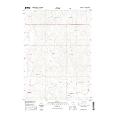
2015 Map of Threemile Butte
USGS Topo · Published 2015About this map
Thunder Basin National Grassland encompasses this high plains landscape in eastern Wyoming, where the Cheyenne River meanders through a network of dry draws and seasonal creeks. The terrain is defined by low-lying ridges and drainage basins, including the aptly named Hungry Hollow and Bum Draw. Human presence is marked by a grid of rural roads such as Cheyenne River Rd and Dutch Joe Rd, reflecting the ranching and resource management character of Niobrara County.
Find a feature on this map
27 named features on this map. Tap any name to fly to it.
Don’t see what you’re looking for? This feature index may not catch every label — zoom into the map to look around manually.
Map Details
Editions of this 2015 Threemile Butte Map
This is the sole edition of this map. No revisions or reprints were ever made.
Other maps of this area

1899 · Newcastle
USGS Topo · 1:125,000

1901 · Newcastle
USGS Topo · 1:125,000

1955 · Newcastle
USGS Topo · 1:250,000

1958 · Newcastle
USGS Topo · 1:250,000

1979 · Newcastle
USGS Topo · 1:100,000

1981 · Horseshoe Bend
USGS Topo · 1:24,000

1981 · Threemile Butte
USGS Topo · 1:24,000
1981 · Little Alkali Creek
USGS Topo · 1:24,000
1981 · Bowen Flat
USGS Topo · 1:24,000
1981 · Boggy Reservoir
USGS Topo · 1:24,000