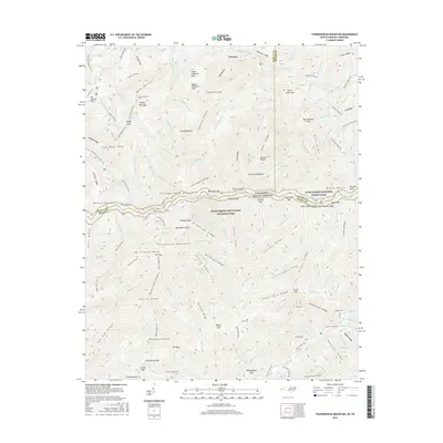
2016 Map of Thunderhead Mountain
USGS Topo · Published 2016About this map
Great Smoky Mountains National Park forms the core of this survey, where the high ridgelines of the Smokies define the boundary between Tennessee and North Carolina. The geography is centered on the massive presence of Thunderhead Mountain and the iconic peak of Rocky Top, accessible via the Appalachian National Scenic Trail which traverses the crest. The settlement of Tremont serves as a northern waypoint near the confluence of W-Prong Little River and Middle Prong Little River.
Find a feature on this map
158 named features on this map. Tap any name to fly to it.
Don’t see what you’re looking for? This feature index may not catch every label — zoom into the map to look around manually.
Map Details
Editions of this 2016 Thunderhead Mountain Map
This is the sole edition of this map. No revisions or reprints were ever made.
Other maps of this area

1886 · Knoxville
USGS Topo · 1:125,000

1892 · Knoxville
USGS Topo · 1:125,000

1894 · Knoxville
USGS Topo · 1:125,000

1895 · Knoxville
USGS Topo · 1:125,000

1901 · Knoxville
USGS Topo · 1:125,000

1933 · Bushnell
USGS Topo · 1:62,500

1935 · Fontana
USGS Topo · 1:24,000

1936 · Proctor
USGS Topo · 1:24,000
1936 · Gatlinburg
USGS Topo · 1:24,000
1936 · Judson
USGS Topo · 1:24,000