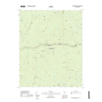
2019 Map of Thunderhead Mountain
USGS Topo · Published 2019About this map
Thunderhead Mountain anchors this high-elevation study of the Tennessee and North Carolina borderlands, dominated by the expansive Great Smoky Mountains National Park. The landscape is defined by its deep drainages and ridges, including the W Prong Little River and Middle Prong Little River, which separate features like Bote Mountain and Sams Ridge. For those researching local history, the map preserves the locations of numerous small family burial grounds such as Wilson Family Cem, Bone Valley Cem, and Walker Cem, which are tucked away in the hollows and gaps.
Find a feature on this map
158 named features on this map. Tap any name to fly to it.
Don’t see what you’re looking for? This feature index may not catch every label — zoom into the map to look around manually.
Map Details
Editions of this 2019 Thunderhead Mountain Map
This is the sole edition of this map. No revisions or reprints were ever made.
Other maps of this area

1886 · Knoxville
USGS Topo · 1:125,000

1892 · Knoxville
USGS Topo · 1:125,000

1894 · Knoxville
USGS Topo · 1:125,000

1895 · Knoxville
USGS Topo · 1:125,000

1901 · Knoxville
USGS Topo · 1:125,000

1933 · Bushnell
USGS Topo · 1:62,500

1935 · Fontana
USGS Topo · 1:24,000

1936 · Proctor
USGS Topo · 1:24,000
1936 · Gatlinburg
USGS Topo · 1:24,000
1936 · Judson
USGS Topo · 1:24,000