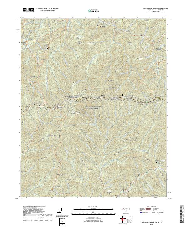
2022 Map of Thunderhead Mountain
USGS Topo · Published 2022About this map
Tremont sits as a primary point of reference in this landscape of significant relief within the Great Smoky Mountains. The terrain is defined by prominent elevations such as Allright Ridge, which dictates the drainage patterns of the local waterways. Small tributaries like Binkroot Br and Laurel Cr carve through the slopes, illustrating the complex hydrology of the North Carolina and Tennessee border region. This 2022 dataset reflects the contemporary state of these protected lands, where the absence of dense modern development preserves the traditional character of the high country. Researchers can trace the sharp topographical shifts that historically influenced movement and settlement throughout the Swain County area.
Find a feature on this map
4 named features on this map. Tap any name to fly to it.
Don’t see what you’re looking for? This feature index may not catch every label — zoom into the map to look around manually.
Map Details
Editions of this 2022 Thunderhead Mountain Map
This is the sole edition of this map. No revisions or reprints were ever made.
Other maps of this area

1886 · Knoxville
USGS Topo · 1:125,000

1892 · Knoxville
USGS Topo · 1:125,000

1894 · Knoxville
USGS Topo · 1:125,000

1895 · Knoxville
USGS Topo · 1:125,000

1901 · Knoxville
USGS Topo · 1:125,000

1933 · Bushnell
USGS Topo · 1:62,500

1935 · Fontana
USGS Topo · 1:24,000

1936 · Proctor
USGS Topo · 1:24,000
1936 · Gatlinburg
USGS Topo · 1:24,000
1936 · Judson
USGS Topo · 1:24,000