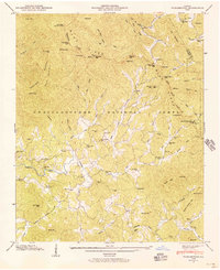
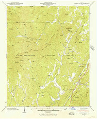
1946 Map of Tickanetley
USGS Topo · Published 1956About this map
Scrougetown Cem and the settlement of Pisgah anchor this 1946 study of the southern Appalachians, which highlights a landscape of dispersed mountain communities and rural institutions. The intricate drainage network of the Cartecay River and Tickanetley Creek dictates the placement of crossroads like Roy and Quill, while the high ridgelines are marked by prominent landmarks such as the Rich Mtn Lookout Tower and Wolfpen Mtn.
Find a feature on this map
83 named features on this map. Tap any name to fly to it.
Don’t see what you’re looking for? This feature index may not catch every label — zoom into the map to look around manually.
Map Details
Editions of this 1946 Tickanetley Map
2 editions found
Other maps of this area

1888 · Ellijay
USGS Topo · 1:125,000

1892 · Ellijay
USGS Topo · 1:125,000

1898 · Ellijay
USGS Topo · 1:125,000

1911 · Ellijay
USGS Topo · 1:125,000

1935 · Noontootla
USGS Topo · 1:24,000
1935 · Cashes Valley
USGS Topo · 1:24,000

1935 · Lake Toccoa
USGS Topo · 1:24,000

1935 · Tickanetley
USGS Topo · 1:24,000
1935 · Wilscot
USGS Topo · 1:24,000
1946 · Cashes Valley
USGS Topo · 1:24,000