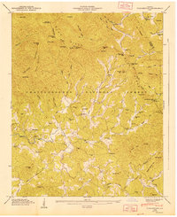
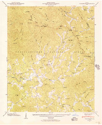
1947 Map of Tickanetley
USGS Topo · Published 1947About this map
Blue Ridge Divide crests through this mountain landscape, marking the high ground where waters separate between the Tennessee Valley and the Atlantic drainage. In the mid-1940s, the rural character of the region is defined by small, isolated settlements like Pisgah and Tickanetley, where community life centered around local institutions such as Mathis Chapel School and New Liberty Ch. The Cartecay River winds through the southern portion of the map, carving a valley that supported early industries like the Stanley Mill and scattered family homesteads near River Hill. Significant elevation changes are noted at peaks like Rich Mtn, which features a Lookout Tower, and the prominent Tickanetley Bald. This survey captures a network of mountain gaps and ridges, including Hard Slate Gap and Rolston Gap, that once dictated the movement of goods and people through the Chattahoochee National Forest.
Find a feature on this map
77 named features on this map. Tap any name to fly to it.
Don’t see what you’re looking for? This feature index may not catch every label — zoom into the map to look around manually.
Map Details
Editions of this 1947 Tickanetley Map
2 editions found
Other maps of this area

1888 · Ellijay
USGS Topo · 1:125,000

1892 · Ellijay
USGS Topo · 1:125,000

1898 · Ellijay
USGS Topo · 1:125,000

1911 · Ellijay
USGS Topo · 1:125,000

1935 · Noontootla
USGS Topo · 1:24,000
1935 · Cashes Valley
USGS Topo · 1:24,000

1935 · Lake Toccoa
USGS Topo · 1:24,000

1935 · Tickanetley
USGS Topo · 1:24,000
1935 · Wilscot
USGS Topo · 1:24,000
1946 · Tickanetley
USGS Topo · 1:24,000