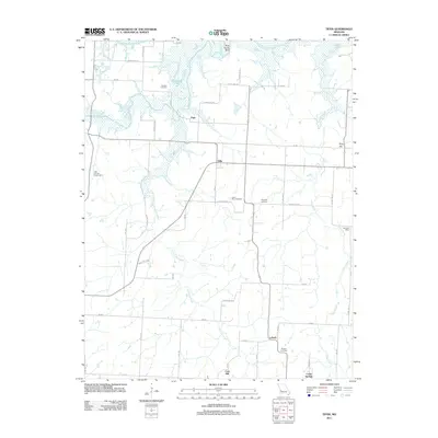
2011 Map of Tiffin
USGS Topo · Published 2011About this map
Pape and Tiffin sit within a landscape defined by the winding course of the Osage River and its varied tributaries. This rural pocket of Missouri, captured as it appeared in the early 21st century, is a patchwork of small communities and family landmarks. Significant creek systems like Little Clear Creek and Simms Creek drain the lowlands, while distinct rises such as Oyer Hill and Coal Hill break the horizon. Genealogy and local history are preserved in several burial grounds, including Landers Cemetery near Horseshoe Lake and Preston Cemetery further south near Lebeck. The presence of the Ebb Post Office on the eastern edge and the Light and Life Church Camp indicates the enduring social and civic focal points that have organized this community for generations.
Find a feature on this map
51 named features on this map. Tap any name to fly to it.
Don’t see what you’re looking for? This feature index may not catch every label — zoom into the map to look around manually.
Map Details
Editions of this 2011 Tiffin Map
This is the sole edition of this map. No revisions or reprints were ever made.
Other maps of this area

1886 · Nevada
USGS Topo · 1:125,000

1886 · Stockton
USGS Topo · 1:125,000

1887 · Clinton
USGS Topo · 1:125,000

1887 · Butler
USGS Topo · 1:125,000

1894 · Butler
USGS Topo · 1:125,000

1894 · Nevada
USGS Topo · 1:125,000

1894 · Clinton
USGS Topo · 1:125,000

1934 · Rockville
USGS Topo · 1:24,000

1937 · Tiffin
USGS Topo · 1:31,680

1938 · Monegaw Springs
USGS Topo · 1:24,000