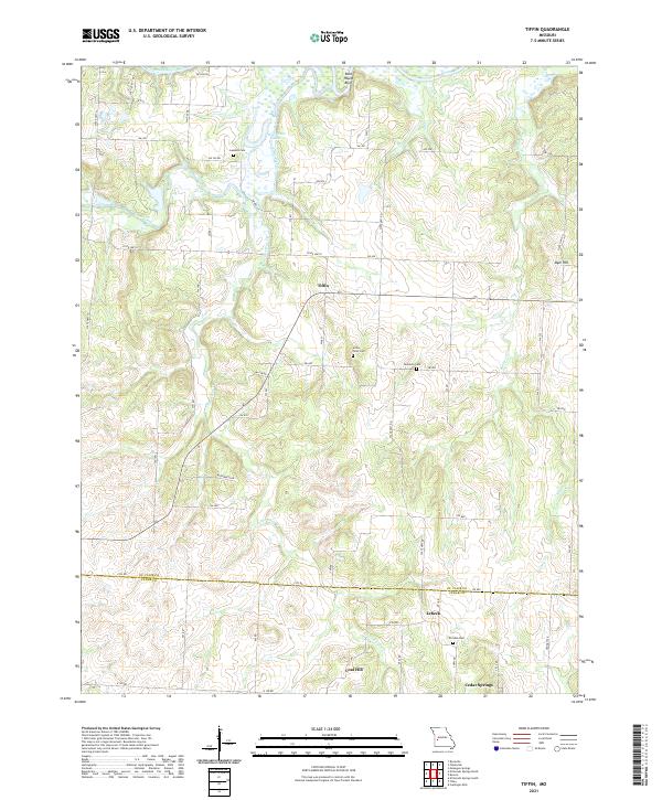
2021 Map of Tiffin
USGS Topo · Published 2021About this map
The Osage River winds along the northern edge of this landscape, its path marked by the prominent Rock House Bluff and the nearby Horseshoe Lake. To the south, the terrain transitions into a patchwork of rural holdings across the border of St. Clair and Cedar Counties. Small settlements including Tiffin, Lebeck, and Cedar Springs serve as local anchors within a network of county roads and state highways. This region is dotted with family and community landmarks that hold significant value for genealogical research, such as Landers Cem, Union Point Cem, Kennerly Cem, and Preston Cem. Topographical features like Coal Hill and Oyer Hill rise above the drainage systems of Little Clear Cr and Simms Cr, reflecting the natural elevations that have shaped the agriculture and settlement patterns of this Missouri borderland.
Find a feature on this map
56 named features on this map. Tap any name to fly to it.
Don’t see what you’re looking for? This feature index may not catch every label — zoom into the map to look around manually.
Map Details
Editions of this 2021 Tiffin Map
This is the sole edition of this map. No revisions or reprints were ever made.
Other maps of this area

1886 · Nevada
USGS Topo · 1:125,000

1886 · Stockton
USGS Topo · 1:125,000

1887 · Clinton
USGS Topo · 1:125,000

1887 · Butler
USGS Topo · 1:125,000

1894 · Butler
USGS Topo · 1:125,000

1894 · Nevada
USGS Topo · 1:125,000

1894 · Clinton
USGS Topo · 1:125,000

1934 · Rockville
USGS Topo · 1:24,000

1937 · Tiffin
USGS Topo · 1:31,680

1938 · Monegaw Springs
USGS Topo · 1:24,000