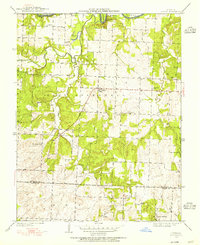
1949 Map of Tiffin
USGS Topo · Published 1955About this map
Osage River meanders across the northern edge of this territory, where Rock House Bluff and Horseshoe Lake define the bottomlands. The upland area is deeply etched by the drainage of Clear Creek and Simms Creek, supporting a dispersed network of rural school districts and small communities during the mid-century. Small settlements like Tiffin and Cedar Springs serve as local hubs, while the landscape is dotted with neighborhood landmarks such as Pape Ch and several country schools including Snyder Sch and Blue Ridge Sch. The survey reveals a community-centered geography, with family and local history anchored at Landers Cem and Kennerly Cem. This documentation by the State of Missouri Geological Survey and Water Resources captures the intricate road and drainage patterns of the East Speedwell region before modern development altered these rural corridors.
Find a feature on this map
27 named features on this map. Tap any name to fly to it.
Don’t see what you’re looking for? This feature index may not catch every label — zoom into the map to look around manually.
Map Details
Editions of this 1949 Tiffin Map
2 editions found
Other maps of this area

1886 · Nevada
USGS Topo · 1:125,000

1886 · Stockton
USGS Topo · 1:125,000

1887 · Clinton
USGS Topo · 1:125,000

1887 · Butler
USGS Topo · 1:125,000

1894 · Butler
USGS Topo · 1:125,000

1894 · Nevada
USGS Topo · 1:125,000

1894 · Clinton
USGS Topo · 1:125,000

1934 · Rockville
USGS Topo · 1:24,000

1937 · Tiffin
USGS Topo · 1:31,680

1938 · Monegaw Springs
USGS Topo · 1:24,000