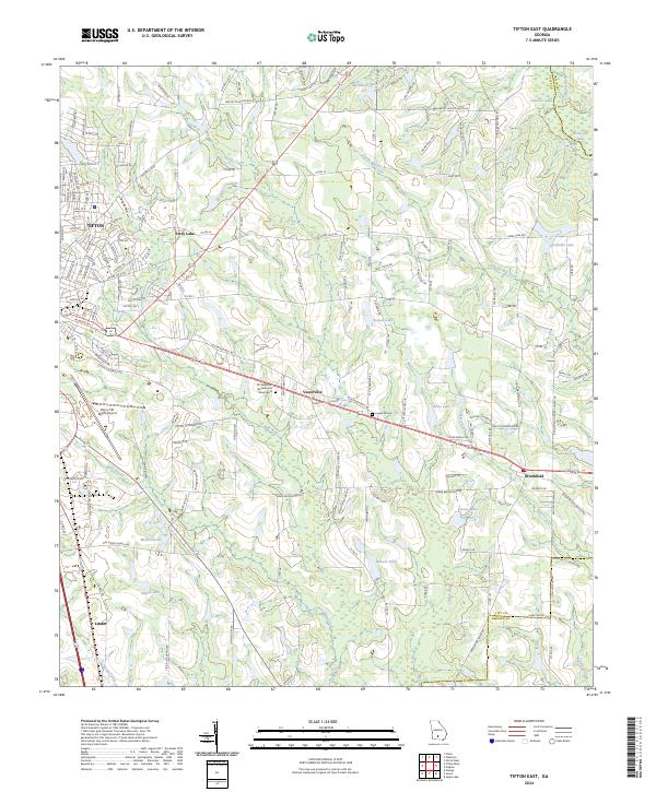
2024 Map of Tifton East
USGS Topo · Published 2024About this map
Tifton serves as the western anchor of this landscape, where residential streets like Lullwater Rd and Diana Ave transition into the rural reaches of Tift County. The New River and its various tributaries, including Hardy Mill Creek and Cypress Creek, define the drainage patterns that separate the smaller settlements of Vanceville and Brookfield. This area is marked by numerous water bodies, ranging from the named McAllister Lake in the north to the cluster of Mullis Ponds and Hawes Lake near Linder in the south.
Find a feature on this map
149 named features on this map. Tap any name to fly to it.
Don’t see what you’re looking for? This feature index may not catch every label — zoom into the map to look around manually.
Map Details
Editions of this 2024 Tifton East Map
This is the sole edition of this map. No revisions or reprints were ever made.
Other maps of this area

1953 · Waycross
USGS Topo · 1:250,000

1958 · Waycross
USGS Topo · 1:250,000

1973 · Ocilla West
USGS Topo · 1:24,000

1973 · Sapps Lake
USGS Topo · 1:24,000

1973 · Waterloo
USGS Topo · 1:24,000

1973 · Enigma
USGS Topo · 1:24,000

1973 · Lenox
USGS Topo · 1:24,000

1973 · Chula
USGS Topo · 1:24,000

1973 · Tifton East
USGS Topo · 1:24,000

1973 · Tifton West
USGS Topo · 1:24,000