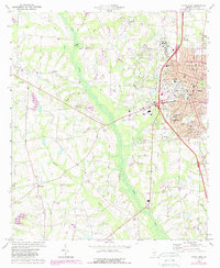
1973 Map of Tifton West
USGS Topo · Published 1988About this map
Tifton emerges as a significant regional hub on this map, showing its mid-century expansion into nearby communities like Phillipsburg and Unionville. The eastern portion of the sheet is dominated by the urban grid, featuring institutions such as Baldwin College and the local Courthouse, while the western terrain transitions into the creek-fed drainage of the Little River. Small rural settlements like Hillsdale and Excelsior are scattered across the landscape, anchored by community landmarks including Zion Hope Ch and Mt Calvary Ch. The transportation network is a central theme, defined by the Georgia Southern and Florida railroad and the presence of an Old Railroad Grade further south. This 1970s survey, updated in the late 1980s, captures the Tift County area as suburban growth began to merge with traditional South Georgia farmland and woodland.
Find a feature on this map
49 named features on this map. Tap any name to fly to it.
Don’t see what you’re looking for? This feature index may not catch every label — zoom into the map to look around manually.
Map Details
Editions of this 1973 Tifton West Map
2 editions found
Other maps of this area

1953 · Waycross
USGS Topo · 1:250,000

1958 · Waycross
USGS Topo · 1:250,000

1973 · Sumner
USGS Topo · 1:24,000

1973 · Ty Ty
USGS Topo · 1:24,000

1973 · Norman Park
USGS Topo · 1:24,000

1973 · Waterloo
USGS Topo · 1:24,000

1973 · Lenox
USGS Topo · 1:24,000

1973 · Chula
USGS Topo · 1:24,000

1973 · Tifton East
USGS Topo · 1:24,000

1973 · Tifton West
USGS Topo · 1:24,000