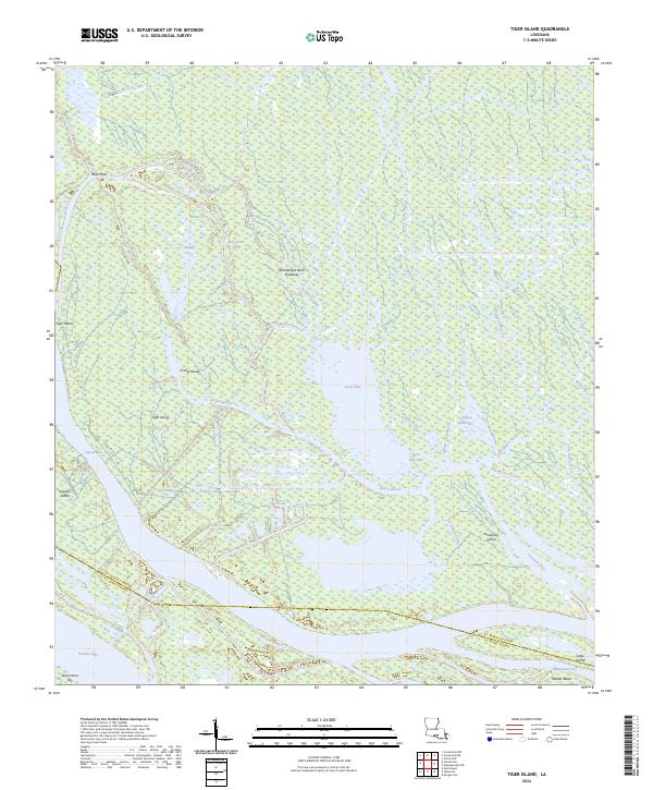
2024 Map of Tiger Island
USGS Topo · Published 2024About this map
The Atchafalaya Basin Floodway dominates this part of St. Martin and St. Mary Parishes, revealing a complex aquatic landscape of bayous, lakes, and low-lying islands. This modern survey illustrates the intricate drainage patterns of the basin, where major water bodies like Duck Lake and Sixmile Lake are linked by a network of smaller channels, including Little Bayou Chene and Bayou Boutte. The terrain is characterized by slightly elevated landmasses such as Tiger Island, Fisher Island, and American Island, which stand out amidst the surrounding wetlands. These landforms, along with Cypress Island and Gray Horse Isle, represent the fragmented shoreline and interior rises of the basin floor. The boundary between the two parishes is traced through these waterways, underscoring the role of the natural hydrography in defining local administrative lines in southern Louisiana.
Find a feature on this map
37 named features on this map. Tap any name to fly to it.
Don’t see what you’re looking for? This feature index may not catch every label — zoom into the map to look around manually.
Map Details
Editions of this 2024 Tiger Island Map
This is the sole edition of this map. No revisions or reprints were ever made.
Other maps of this area

1935 · Morgan City
USGS Topo · 1:62,500

1941 · Belle Isle
USGS Topo · 1:62,500

1945 · New Orleans
USGS Topo · 1:250,000

1948 · Foster
USGS Topo · 1:62,500

1953 · Napoleonville
USGS Topo · 1:62,500

1954 · Morgan City
USGS Topo · 1:62,500

1954 · Belle Isle
USGS Topo · 1:62,500

1959 · Foster
USGS Topo · 1:62,500

1963 · New Orleans
USGS Topo · 1:250,000

1966 · New Orleans
USGS Topo · 1:250,000