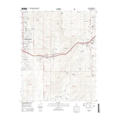
2013 Map of Tijeras
USGS Topo · Published 2013About this map
Cibola National Forest dominates this landscape where the eastern edge of Albuquerque meets the dramatic rises of the Sandia Mountains and Manzanita Mountains. The map documents a corridor of mountain communities connected by State Hwy 333, including Carnuel, Monticello, and the village of Tijeras. These settlements are interspersed with historical sites like the Santo Niño Cem and Carnuel Cem, reflecting the deep-rooted cultural geography of the canyon. The transition from urban street grids like Menaul Blvd NE and Copper Ave NE to rugged trailheads like Piedra Lisa Canyon Trailhead and Three Gun Spring Trailhead illustrates the immediate proximity of wild terrain to New Mexico's largest city. Topographical details such as Embudo Canyon and South Sandia Peak provide a clear view of the drainage patterns and peaks that define the local watershed.
Find a feature on this map
74 named features on this map. Tap any name to fly to it.
Don’t see what you’re looking for? This feature index may not catch every label — zoom into the map to look around manually.
Map Details
Editions of this 2013 Tijeras Map
This is the sole edition of this map. No revisions or reprints were ever made.
Other maps of this area

1888 · Bernalillo
USGS Topo · 1:125,000

1889 · Albuquerque
USGS Topo · 1:125,000

1892 · San Pedro
USGS Topo · 1:125,000

1893 · Albuquerque
USGS Topo · 1:125,000

1917 · Estancia
USGS Topo · 1:125,000

1934 · Alameda
USGS Topo · 1:24,000

1934 · East Albuquerque
USGS Topo · 1:24,000

1938 · Albuquerque
USGS Topo · 1:62,500

1952 · Hubbell Spring
USGS Topo · 1:24,000

1954 · Sandia Crest
USGS Topo · 1:24,000