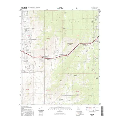
2017 Map of Tijeras
USGS Topo · Published 2017About this map
The Sandia Mountains and Manzanita Mountains converge in this transition between the high desert floor and the wooded slopes of the Cibola National Forest. The landscape is defined by its canyon systems, most notably Tijeras Arroyo, which has served as a primary transit corridor through the mountains for generations. Small settlements like Carnuel, Tijeras, and San Antonio cluster near these vital mountain passes. Local history is preserved in traditional burial grounds such as Santo Niño Camposanto Cem and the Carnuel Cem.
Find a feature on this map
86 named features on this map. Tap any name to fly to it.
Don’t see what you’re looking for? This feature index may not catch every label — zoom into the map to look around manually.
Map Details
Editions of this 2017 Tijeras Map
This is the sole edition of this map. No revisions or reprints were ever made.
Other maps of this area

1888 · Bernalillo
USGS Topo · 1:125,000

1889 · Albuquerque
USGS Topo · 1:125,000

1892 · San Pedro
USGS Topo · 1:125,000

1893 · Albuquerque
USGS Topo · 1:125,000

1917 · Estancia
USGS Topo · 1:125,000

1934 · Alameda
USGS Topo · 1:24,000

1934 · East Albuquerque
USGS Topo · 1:24,000

1938 · Albuquerque
USGS Topo · 1:62,500

1952 · Hubbell Spring
USGS Topo · 1:24,000

1954 · Sandia Crest
USGS Topo · 1:24,000