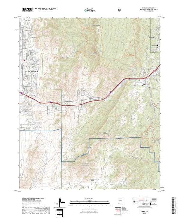
2023 Map of Tijeras
USGS Topo · Published 2023About this map
Tijeras Canyon serves as a natural gateway between the Sandia Mountain Wilderness and the Manzanita Mountains, defining the geography where eastern Albuquerque meets the high desert. This survey documents the intersection of modern suburban expansion and traditional land grants, showing the ribbon of development through Carnuel and Tijeras. High elevations are marked by South Sandia Peak and a network of seasonal water sources like Embudo Spring and Sandia Spring. To the south, the boundary of Kirtland Air Force Base transitions into the Cibola National Forest, where steep drainages like Lurance Canyon and Arroyo del Coyote dominate the terrain. Local history is anchored by numerous burial sites, including the Santo Niño Camposanto Cem and the San Antonio Cem Annex, reflecting the long-standing communities of the East Mountains.
Find a feature on this map
91 named features on this map. Tap any name to fly to it.
Don’t see what you’re looking for? This feature index may not catch every label — zoom into the map to look around manually.
Map Details
Editions of this 2023 Tijeras Map
This is the sole edition of this map. No revisions or reprints were ever made.
Other maps of this area

1888 · Bernalillo
USGS Topo · 1:125,000

1889 · Albuquerque
USGS Topo · 1:125,000

1892 · San Pedro
USGS Topo · 1:125,000

1893 · Albuquerque
USGS Topo · 1:125,000

1917 · Estancia
USGS Topo · 1:125,000

1934 · Alameda
USGS Topo · 1:24,000

1934 · East Albuquerque
USGS Topo · 1:24,000

1938 · Albuquerque
USGS Topo · 1:62,500

1952 · Hubbell Spring
USGS Topo · 1:24,000

1954 · Sandia Crest
USGS Topo · 1:24,000