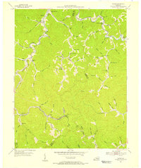
1954 Map of Tilford
USGS Topo · Published 1956About this map
The Louisville and Nashville railroad winds through the narrow valleys of this Kentucky coal country, following the path of Little Leatherwood Creek and its many tributaries. In the mid-1950s, this landscape is defined by small, dispersed settlements like Slemp, Daisy, and Tilford, which are tethered together by the rail line and a network of hollows. The social fabric of these remote communities is visible in the numerous neighborhood institutions, including Mt Olivet Ch and schools like Holcomb Sch and Beehive Sch. The map reveals the intricate drainage patterns of the Cumberland Plateau, where every branch and fork—such as Beech Rock Br and Stony Fork—serves as a primary corridor for settlement and transit. The boundary between Perry and Letcher counties follows the high ridges, separating the many homesteads and schoolhouses that populate nearly every accessible creek bottom.
Find a feature on this map
79 named features on this map. Tap any name to fly to it.
Don’t see what you’re looking for? This feature index may not catch every label — zoom into the map to look around manually.
Map Details
Editions of this 1954 Tilford Map
Other maps of this area

1887 · Jonesville
USGS Topo · 1:125,000

1890 · Whitesburg
USGS Topo · 1:125,000

1891 · Hazard
USGS Topo · 1:125,000

1891 · Jonesville
USGS Topo · 1:125,000

1892 · Whitesburg
USGS Topo · 1:125,000

1894 · Estillville
USGS Topo · 1:125,000

1913 · Oven Fork
USGS Topo · 1:48,000

1915 · Whitesburg
USGS Topo · 1:62,500

1916 · Cornettsville
USGS Topo · 1:62,500

1916 · Nolansburg
USGS Topo · 1:48,000