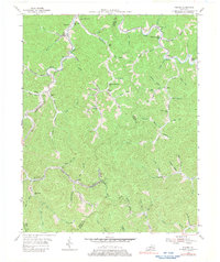
1954 Map of Tilford
USGS Topo · Published 1980About this map
Louisville and Nashville rail lines trace the narrow valley floors of Perry and Letcher counties in this mid-century topographic survey. The landscape is defined by its intricate drainage networks, where settlements like Tilford and Delphia are positioned along the winding Fork and Little Leatherwood Creek. These small communities grew around the intersection of rail transport and river valleys, providing a look at the industrial and social hubs of the Kentucky coalfields before significant later-century alterations.
Find a feature on this map
86 named features on this map. Tap any name to fly to it.
Don’t see what you’re looking for? This feature index may not catch every label — zoom into the map to look around manually.
Map Details
Editions of this 1954 Tilford Map
Other maps of this area

1887 · Jonesville
USGS Topo · 1:125,000

1890 · Whitesburg
USGS Topo · 1:125,000

1891 · Hazard
USGS Topo · 1:125,000

1891 · Jonesville
USGS Topo · 1:125,000

1892 · Whitesburg
USGS Topo · 1:125,000

1894 · Estillville
USGS Topo · 1:125,000

1913 · Oven Fork
USGS Topo · 1:48,000

1915 · Whitesburg
USGS Topo · 1:62,500

1916 · Cornettsville
USGS Topo · 1:62,500

1916 · Nolansburg
USGS Topo · 1:48,000