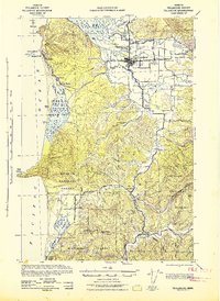
1942 Map of Tillamook
USGS Topo · Published 1942About this map
Tillamook serves as the focal point of this 1942 War Department survey, situated where the Wilson River, Trask River, and Tillamook River converge into Tillamook Bay. The landscape reveals a complex network of tidewater sloughs, including Hall Slough, Dougherty Slough, and Hoquarten Slough, which defined the local maritime and industrial geography during the early war years. Along the coast, the settlements of Oceanside, Netarts, and Silver Sands are documented alongside prominent landmarks like Cape Meares and the Three Arch Rocks Bird Reserve.
Find a feature on this map
54 named features on this map. Tap any name to fly to it.
Don’t see what you’re looking for? This feature index may not catch every label — zoom into the map to look around manually.
Map Details
Editions of this 1942 Tillamook Map
2 editions found
Other maps of this area

1937 · Nehalem
USGS Topo · 1:62,500

1937 · Enright
USGS Topo · 1:62,500

1941 · Nestucca Bay
USGS Topo · 1:62,500

1941 · Enright
USGS Topo · 1:62,500

1942 · Ginger Peak
USGS Topo · 1:62,500

1942 · Spirit Mtn
USGS Topo · 1:62,500

1942 · Nestucca Bay
USGS Topo · 1:62,500

1942 · Tillamook
USGS Topo · 1:62,500

1943 · Nehalem
USGS Topo · 1:62,500

1948 · Vancouver
USGS Topo · 1:250,000