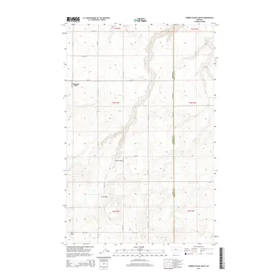
2014 Map of Timber Coulee South
USGS Topo · Published 2014About this map
Diamond Valley occupies the northwest portion of this landscape, set against the high ground of Teton Ridge and the dramatic relief of Timber Coulee. The terrain is defined by the sharp transition between level plains and deep drainages, with Rye Coulee cutting through the southwestern corner. This 2014 survey documents the modern layout of the Teton County and Chouteau County line, showing a rural grid of secondary roads like Dutton Rd E and MT-379 that navigate the ridges and depressions. The placement of these settlements and named geographical features suggests a land shaped by water erosion and agricultural necessity, where the coulees provide natural breaks in the vast Montana plains.
Find a feature on this map
26 named features on this map. Tap any name to fly to it.
Don’t see what you’re looking for? This feature index may not catch every label — zoom into the map to look around manually.
Map Details
Editions of this 2014 Timber Coulee South Map
This is the sole edition of this map. No revisions or reprints were ever made.
Other maps of this area

1886 · Great Falls
USGS Topo · 1:250,000

1949 · Timber Coulee
USGS Topo · 1:62,500

1949 · Great Falls
USGS Topo · 1:62,500

1949 · Vaughn
USGS Topo · 1:62,500

1950 · Timber Coulee
USGS Topo · 1:62,500

1950 · Dutton
USGS Topo · 1:62,500

1951 · Great Falls
USGS Topo · 1:62,500

1952 · Vaughn
USGS Topo · 1:62,500

1954 · Great Falls
USGS Topo · 1:250,000

1957 · Great Falls
USGS Topo · 1:250,000