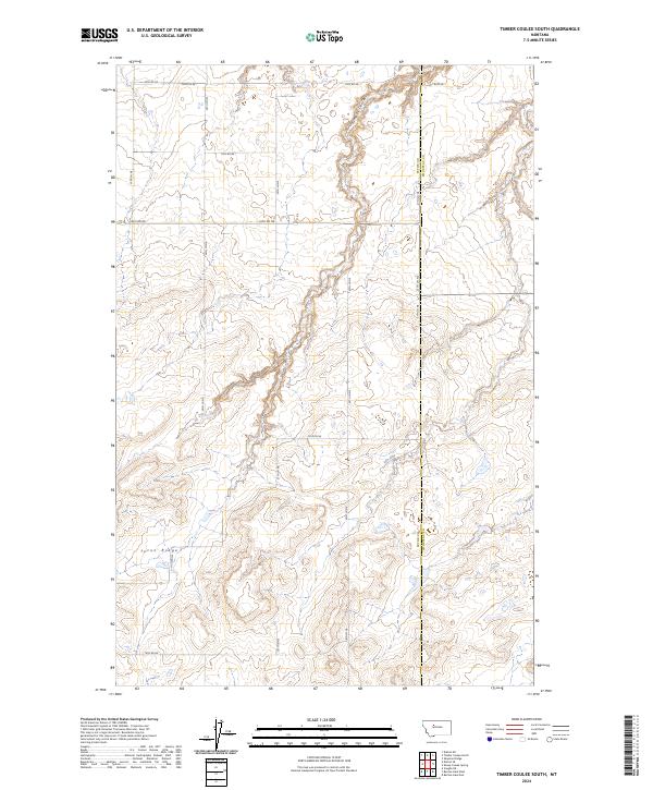
2024 Map of Timber Coulee South
USGS Topo · Published 2024About this map
Teton Ridge dominates the southern portion of this landscape, where the elevation drops into the drainage systems of north-central Montana. The terrain is defined by the stark division between Teton Co and Chouteau Co, a political boundary that cuts through the open high plains. Water is the primary architect of this geography, specifically the namesake Timber Coulee which winds through the northern sections, creating the distinct topographical relief that characterizes the quadrangle. The human footprint is traced through a grid-like network of rural routes, including 18th Rd Ne, 16th Rd Ne, and Bliss Ln, which follow the township and range lines. This modern survey reflects the enduring spatial organization of the West, where land use and movement are dictated by a combination of section lines and the natural contours of the coulee systems.
Find a feature on this map
16 named features on this map. Tap any name to fly to it.
Don’t see what you’re looking for? This feature index may not catch every label — zoom into the map to look around manually.
Map Details
Editions of this 2024 Timber Coulee South Map
This is the sole edition of this map. No revisions or reprints were ever made.
Other maps of this area

1886 · Great Falls
USGS Topo · 1:250,000

1949 · Timber Coulee
USGS Topo · 1:62,500

1949 · Great Falls
USGS Topo · 1:62,500

1949 · Vaughn
USGS Topo · 1:62,500

1950 · Timber Coulee
USGS Topo · 1:62,500

1950 · Dutton
USGS Topo · 1:62,500

1951 · Great Falls
USGS Topo · 1:62,500

1952 · Vaughn
USGS Topo · 1:62,500

1954 · Great Falls
USGS Topo · 1:250,000

1957 · Great Falls
USGS Topo · 1:250,000