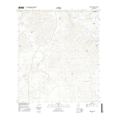
2016 Map of Timber Creek
USGS Topo · Published 2016About this map
The hydrological network of the Balcones Escarpment region defines this 2016 survey, where the Middle Verde Recharge Lake and the western edge of Medina Lake highlight the critical water management systems of the Texas Hill Country. The landscape is characterized by a dense system of seasonal drainages and named springs, such as Pecan Grove Spring and Moccasin Spring, which feed into major arteries like Middle Verde Creek and Main Quihi Creek. This topographic record illustrates the transition from the upland divides of One Horn Mtn and Chimney Hill down into the narrow alluvial valleys that have historically supported ranching and transit.
Find a feature on this map
54 named features on this map. Tap any name to fly to it.
Don’t see what you’re looking for? This feature index may not catch every label — zoom into the map to look around manually.
Map Details
Editions of this 2016 Timber Creek Map
This is the sole edition of this map. No revisions or reprints were ever made.
Other maps of this area
1954 · San Antonio
USGS Topo · 1:250,000
1956 · New Fountain
USGS Topo · 1:62,500
1956 · Bandera
USGS Topo · 1:62,500
1956 · Medina Lake
USGS Topo · 1:62,500
1957 · San Antonio
USGS Topo · 1:250,000
1964 · Riomedina
USGS Topo · 1:24,000
1964 · Bandera
USGS Topo · 1:24,000
1964 · Timber Creek
USGS Topo · 1:24,000
1964 · Medina Lake
USGS Topo · 1:24,000
1964 · Tarpley Pass
USGS Topo · 1:24,000