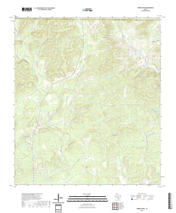
2022 Map of Timber Creek
USGS Topo · Published 2022About this map
Middle Verde Cr and its various forks define the drainage patterns of this Central Texas landscape, where the Bandera and Medina county lines meet. The terrain is characterized by a series of named hollows and canyons, including Pigpen Hollow and Water Canyon, which channel water toward the primary creeks. Significant water resources are visible in the form of numerous springs, such as Cypress Creek Spring, Indian Spring, and Moccasin Spring, indicating the importance of groundwater in this region.
Find a feature on this map
53 named features on this map. Tap any name to fly to it.
Don’t see what you’re looking for? This feature index may not catch every label — zoom into the map to look around manually.
Map Details
Editions of this 2022 Timber Creek Map
This is the sole edition of this map. No revisions or reprints were ever made.
Other maps of this area

1954 · San Antonio
USGS Topo · 1:250,000

1956 · New Fountain
USGS Topo · 1:62,500

1956 · Bandera
USGS Topo · 1:62,500

1956 · Medina Lake
USGS Topo · 1:62,500

1957 · San Antonio
USGS Topo · 1:250,000

1964 · Riomedina
USGS Topo · 1:24,000

1964 · Bandera
USGS Topo · 1:24,000

1964 · Timber Creek
USGS Topo · 1:24,000

1964 · Medina Lake
USGS Topo · 1:24,000
1964 · Tarpley Pass
USGS Topo · 1:24,000