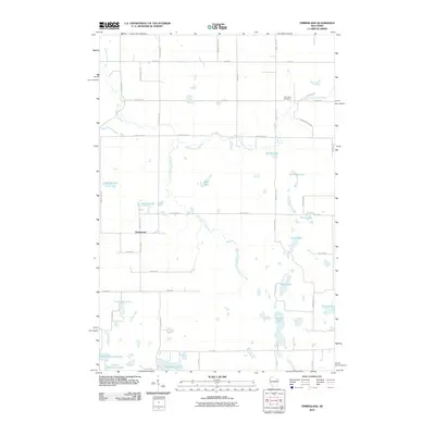
2010 Map of Timberland
USGS Topo · Published 2010About this map
The settlement of Timberland anchors this pocket of Northwest Wisconsin, where the drainage of the North Fork Clam River and the South Fork Clam River defines the landscape. The area is densely patterned with glacial kettle lakes, including family-named water bodies like Severson Lake, Kinny Lake, and Leach Lake. A network of early roads, such as Bashaw Store Rd, Sawmill Rd, and the curiously named Narrow Gauge Rd, suggests a landscape shaped by the regional timber and agricultural economy. For those researching local history or genealogy, the Clam River Cemetery is situated in the northeastern quadrant near the bend of the North Fork. The map captures the intricate hydrology of the region, from the cluster of southern waters including Upper Waterman Lake and Lower Waterman Lake to the scattered wetlands that connect these diverse aquatic systems.
Find a feature on this map
49 named features on this map. Tap any name to fly to it.
Don’t see what you’re looking for? This feature index may not catch every label — zoom into the map to look around manually.
Map Details
Editions of this 2010 Timberland Map
This is the sole edition of this map. No revisions or reprints were ever made.
Other maps of this area

1948 · Spooner
USGS Topo · 1:48,000

1949 · Hertel
USGS Topo · 1:48,000

1949 · Spooner
USGS Topo · 1:48,000

1951 · Cumberland
USGS Topo · 1:48,000

1951 · Shell Lake
USGS Topo · 1:48,000

1953 · Rice Lake
USGS Topo · 1:250,000

1953 · Stillwater
USGS Topo · 1:250,000

1955 · Hertel
USGS Topo · 1:62,500

1955 · Stillwater
USGS Topo · 1:250,000

1956 · Cumberland
USGS Topo · 1:62,500