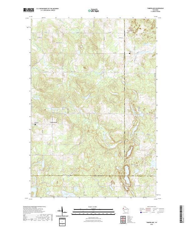
2022 Map of Timberland
USGS Topo · Published 2022About this map
Timberland anchors this northwestern Wisconsin landscape, situated near the intersection of Timberland Rd and Co Hwy J. The area is defined by a dense network of glacial lakes and river systems, including the N Fork Clam River and the S Fork Clam River which wind through the township boundaries of Burnett, Washburn, and Barron counties. Genealogists will find the Timberland Ringebu Cem and the Clam River Cem near the northern reaches. The Ice Age National Scenic Trl meanders across the southern half of the quadrangle, passing through lowlands near Horseshoe Lake and Upper Waterman Lake. This map captures the rural character of the region, where family-named roads like Bartels Ln and Rosmos Ln connect scattered homesteads amidst a mosaic of wetlands and small water bodies such as Severson Lake and Peacock Lake.
Find a feature on this map
68 named features on this map. Tap any name to fly to it.
Don’t see what you’re looking for? This feature index may not catch every label — zoom into the map to look around manually.
Map Details
Editions of this 2022 Timberland Map
This is the sole edition of this map. No revisions or reprints were ever made.
Other maps of this area

1948 · Spooner
USGS Topo · 1:48,000

1949 · Hertel
USGS Topo · 1:48,000

1949 · Spooner
USGS Topo · 1:48,000

1951 · Cumberland
USGS Topo · 1:48,000

1951 · Shell Lake
USGS Topo · 1:48,000

1953 · Rice Lake
USGS Topo · 1:250,000

1953 · Stillwater
USGS Topo · 1:250,000

1955 · Hertel
USGS Topo · 1:62,500

1955 · Stillwater
USGS Topo · 1:250,000

1956 · Cumberland
USGS Topo · 1:62,500