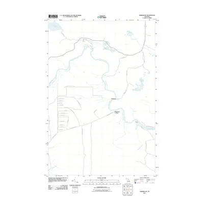
2011 Map of Timberlost
USGS Topo · Published 2011About this map
The Tahquamenon River winds through this heavily forested portion of the Upper Peninsula, defining the landscape around Tahquamenon Falls State Park. The map documents the northern reaches of the river near the Lower Falls, a region historically central to the timber industry. The small settlements of Timberlost and Whitehouse Landing are situated along the riverbanks, connected by a network of logging roads and grades such as Culhane Grade Rd and Cadillac Soo Rd. These names hint at the area's transition from a logging frontier to a destination for outdoor recreation, further evidenced by Bowers Lodge and numerous small water bodies like Water Tank Lakes, Cabin Lake, and Camp Ten Lakes. The intricate maze of local tracks, including N Sawhorse Ln and Ensing Row, highlights the modern residential and seasonal development patterns in this remote Michigan wilderness.
Find a feature on this map
42 named features on this map. Tap any name to fly to it.
Don’t see what you’re looking for? This feature index may not catch every label — zoom into the map to look around manually.
Map Details
Editions of this 2011 Timberlost Map
This is the sole edition of this map. No revisions or reprints were ever made.
Other maps of this area

1951 · Shelldrake
USGS Topo · 1:24,000

1951 · Sheephead Lake
USGS Topo · 1:24,000

1951 · Emerson
USGS Topo · 1:24,000

1951 · Piatt Lake
USGS Topo · 1:24,000

1951 · Big Beaver Creek
USGS Topo · 1:24,000

1951 · Timberlost
USGS Topo · 1:24,000

1951 · Eckerman
USGS Topo · 1:62,500

1951 · Shelldrake
USGS Topo · 1:62,500

1954 · Sault Sainte Marie
USGS Topo · 1:250,000

1956 · Sault Sainte Marie
USGS Topo · 1:250,000