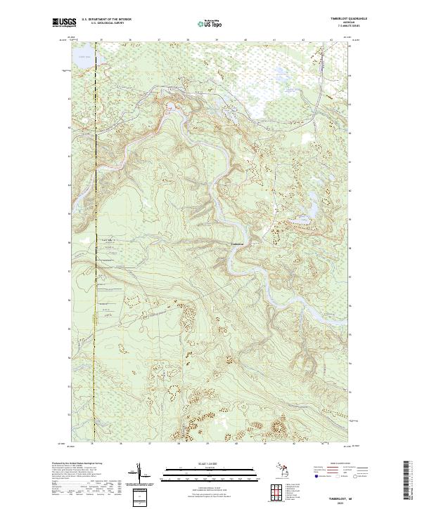
2023 Map of Timberlost
USGS Topo · Published 2023About this map
The Tahquamenon River winds through this heavily forested landscape in the Upper Peninsula, providing a central artery for a region defined by its water and timber history. Near the settlement of Timberlost, the terrain is marked by a complex network of glacial features, including the Water Tank Lakes, Camp Ten Lakes, and Cabin Lake. The geography is bisected by the Luce Co and Chippewa Co boundary, where old transport routes like the Culhane Grade Rd and W Cat-Soo Grade Rd suggest the region's historical reliance on logging grades and wilderness transit.
Find a feature on this map
43 named features on this map. Tap any name to fly to it.
Don’t see what you’re looking for? This feature index may not catch every label — zoom into the map to look around manually.
Map Details
Editions of this 2023 Timberlost Map
This is the sole edition of this map. No revisions or reprints were ever made.
Other maps of this area

1951 · Shelldrake
USGS Topo · 1:24,000

1951 · Sheephead Lake
USGS Topo · 1:24,000

1951 · Emerson
USGS Topo · 1:24,000

1951 · Piatt Lake
USGS Topo · 1:24,000

1951 · Big Beaver Creek
USGS Topo · 1:24,000

1951 · Timberlost
USGS Topo · 1:24,000

1951 · Eckerman
USGS Topo · 1:62,500

1951 · Shelldrake
USGS Topo · 1:62,500

1954 · Sault Sainte Marie
USGS Topo · 1:250,000

1956 · Sault Sainte Marie
USGS Topo · 1:250,000