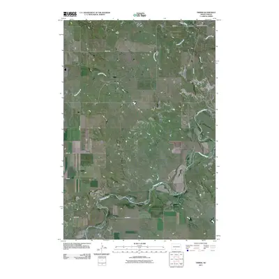
2011 Map of Timmer
USGS Topo · Published 2011About this map
The Cannonball River meanders across this rural Morton County landscape, defining the topography of a region dominated by sweeping plains and riparian corridors. Near the northern boundary, the small settlement of Timmer serves as a local anchor point, situated just west of the Saint George Cemetery. The area's drainage is further defined by the winding paths of Dogtooth Creek and Louse Creek, which flow through the north-central section of the map. This early 21st-century survey illustrates a remote transport network relying on a grid of section roads like County Rd 82 and Bia Route 7, reflecting the enduring agricultural and tribal land patterns of the Missouri Plateau. For those researching local lineages or geography, the map provides a precise layout of the roads and watercourses that have shaped this community for generations.
Find a feature on this map
15 named features on this map. Tap any name to fly to it.
Don’t see what you’re looking for? This feature index may not catch every label — zoom into the map to look around manually.
Map Details
Editions of this 2011 Timmer Map
This is the sole edition of this map. No revisions or reprints were ever made.
Other maps of this area

1954 · Bismarck
USGS Topo · 1:250,000

1958 · Bismarck
USGS Topo · 1:250,000

1971 · Froelich Dam
USGS Topo · 1:24,000

1971 · Shields
USGS Topo · 1:24,000

1971 · Solen SW
USGS Topo · 1:24,000

1971 · Porcupine
USGS Topo · 1:24,000

1971 · Timmer
USGS Topo · 1:24,000

1980 · Breien
USGS Topo · 1:24,000

1980 · Freda
USGS Topo · 1:24,000

1980 · Burgess
USGS Topo · 1:24,000