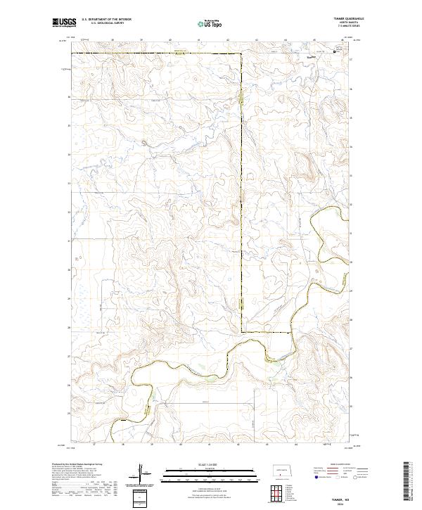
2024 Map of Timmer
USGS Topo · Published 2024About this map
The Cannonball River meanders across the southern portion of this landscape, carving a distinct valley through the rolling plains of North Dakota. In the northern reaches, the community of Timmer serves as a local focal point near the Morton and Grant county line. This area reflects a traditional prairie settlement pattern where section-line roads like 72nd St and 80th St provide the primary framework for travel between isolated farmsteads and rural landmarks. Local history is anchored by the Saint George Cem in the northeast, while the drainage of Dogtooth Creek shapes the central topography. The map illustrates a rural interior where the river remains the most prominent natural feature, dictating the placement of secondary routes and land boundaries.
Find a feature on this map
28 named features on this map. Tap any name to fly to it.
Don’t see what you’re looking for? This feature index may not catch every label — zoom into the map to look around manually.
Map Details
Editions of this 2024 Timmer Map
This is the sole edition of this map. No revisions or reprints were ever made.
Other maps of this area

1954 · Bismarck
USGS Topo · 1:250,000

1958 · Bismarck
USGS Topo · 1:250,000

1971 · Froelich Dam
USGS Topo · 1:24,000

1971 · Shields
USGS Topo · 1:24,000

1971 · Solen SW
USGS Topo · 1:24,000

1971 · Porcupine
USGS Topo · 1:24,000

1971 · Timmer
USGS Topo · 1:24,000

1980 · Breien
USGS Topo · 1:24,000

1980 · Freda
USGS Topo · 1:24,000

1980 · Burgess
USGS Topo · 1:24,000