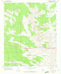
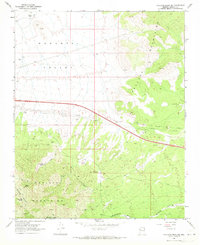
1968 Map of Tin Mountain NW
USGS Topo · Published 1972About this map
McGarrys sits within a landscape defined by utility and transport infrastructure in this late 1960s study of Mohave County. The emergence of the Round Valley Interchange and several extensive Pipelines cutting across the terrain highlights the mid-century industrialization of this region. Notable landmarks of development include a Compressor Station, an Oil Sump, and the Sewage Disposal Pond, which together suggest a period of active resource management and logistical expansion. Water management is further evidenced by the Cofer Dam and various tanks. The topography is marked by several Borrow Pits and a network of unimproved routes like the Jeep Trail, illustrating how the area was being physically shaped by construction and transport needs during this era.
Find a feature on this map
14 named features on this map. Tap any name to fly to it.
Don’t see what you’re looking for? This feature index may not catch every label — zoom into the map to look around manually.
Map Details
Editions of this 1968 Tin Mountain NW Map
2 editions found
Other maps of this area

1886 · Diamond Creek
USGS Topo · 1:250,000

1892 · Diamond Creek
USGS Topo · 1:250,000

1948 · Williams
USGS Topo · 1:250,000

1954 · Williams
USGS Topo · 1:250,000

1956 · Williams
USGS Topo · 1:250,000

1960 · Williams
USGS Topo · 1:250,000

1961 · Williams
USGS Topo · 1:250,000
1968 · Austin Peak
USGS Topo · 1:24,000
1968 · Peacock Peak
USGS Topo · 1:24,000
1968 · Hualapai Peak NE
USGS Topo · 1:24,000