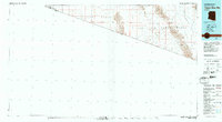
1980 Map of Tinajas Altas Mts
USGS Topo · Published 1980About this map
The United States Mexico border defines the southern extent of this arid landscape, where the Yuma Desert transitions into the rugged peaks of the Tinajas Altas Mountains and the Gila Mountains. Much of the territory is dedicated to military use within the Luke Air Force Range, a vast expanse that includes the Davis Plain and the shifting Sand Dunes near the international boundary.
Find a feature on this map
21 named features on this map. Tap any name to fly to it.
Don’t see what you’re looking for? This feature index may not catch every label — zoom into the map to look around manually.
Map Details
Editions of this 1980 Tinajas Altas Mts Map
2 editions found
Other maps of this area

1903 · Yuma
USGS Topo · 1:125,000

1905 · Yuma
USGS Topo · 1:125,000

1907 · Holtville
USGS Topo · 1:125,000

1926 · Fortuna
USGS Topo · 1:62,500

1926 · Wellton
USGS Topo · 1:62,500

1926 · Mohawk
USGS Topo · 1:62,500

1928 · Mohawk
USGS Topo · 1:62,500

1929 · Fortuna
USGS Topo · 1:62,500

1929 · Wellton
USGS Topo · 1:62,500

1940 · Yuma
USGS Topo · 1:62,500