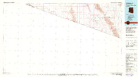
1980 Map of Tinajas Altas Mts
USGS Topo · Published 1980About this map
The United States Mexico border defines the southern extent of this 1980 survey, where the arid landscape of Yuma Co is dominated by the Luke Air Force Range. This vast military reservation encompasses the Tinajas Altas Mountains and the Gila Mountains, terrain characterized by dramatic elevation changes such as Vopoki Ridge and Raven Butte. The map illustrates the harsh geometry of the Yuma Desert and Lechuguilla Desert, split by the Butler Mountains. Human activity is sparse but notable, with a Jeep Trail winding through the remote sectors and the San Luis Landing Field positioned near the international boundary. Geologic and industrial interests are represented by the Smith Mine, while natural landmarks like the shifting Sand Dunes and the drainage of Coyote Wash highlight the dynamic nature of this southwestern environment.
Find a feature on this map
20 named features on this map. Tap any name to fly to it.
Don’t see what you’re looking for? This feature index may not catch every label — zoom into the map to look around manually.
Map Details
Editions of this 1980 Tinajas Altas Mts Map
2 editions found
Other maps of this area

1903 · Yuma
USGS Topo · 1:125,000

1905 · Yuma
USGS Topo · 1:125,000

1907 · Holtville
USGS Topo · 1:125,000

1926 · Fortuna
USGS Topo · 1:62,500

1926 · Wellton
USGS Topo · 1:62,500

1926 · Mohawk
USGS Topo · 1:62,500

1928 · Mohawk
USGS Topo · 1:62,500

1929 · Fortuna
USGS Topo · 1:62,500

1929 · Wellton
USGS Topo · 1:62,500

1940 · Yuma
USGS Topo · 1:62,500