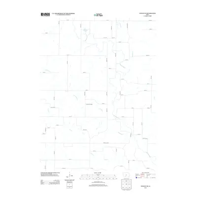
2013 Map of Tingley NE
USGS Topo · Published 2013About this map
The Thompson River meanders southward through this rural Decatur County landscape, serving as the central drainage for a network of creek systems including Twelvemile Cr, Sevenmile Cr, and Fourmile Cr. The terrain is defined by the agricultural grid of Iowa's southern tier, punctuated by the Spring Valley Lake reservoir in the north. A significant crossing point is found at the Grand River Bridge on 255th St, reflecting the persistent importance of river infrastructure in maintaining the connectivity of this rural township. The presence of Church St and a well-developed network of county roads like Co Hwy-H37 and Co Hwy-P64 underscores the density of local farmsteads and rural residences. Near the southern edge, the map identifies Clarke Decatur St, tracing the jurisdictional boundary through the creek bottoms of Sand Cr.
Find a feature on this map
54 named features on this map. Tap any name to fly to it.
Don’t see what you’re looking for? This feature index may not catch every label — zoom into the map to look around manually.
Map Details
Editions of this 2013 Tingley NE Map
This is the sole edition of this map. No revisions or reprints were ever made.
Other maps of this area

1951 · Osceola
USGS Topo · 1:62,500

1951 · Afton
USGS Topo · 1:62,500

1954 · Centerville
USGS Topo · 1:250,000

1954 · Omaha
USGS Topo · 1:250,000

1954 · Des Moines
USGS Topo · 1:250,000

1955 · Nebraska City
USGS Topo · 1:250,000

1956 · Des Moines
USGS Topo · 1:250,000

1957 · Des Moines
USGS Topo · 1:250,000

1957 · Nebraska City
USGS Topo · 1:250,000

1957 · Omaha
USGS Topo · 1:250,000