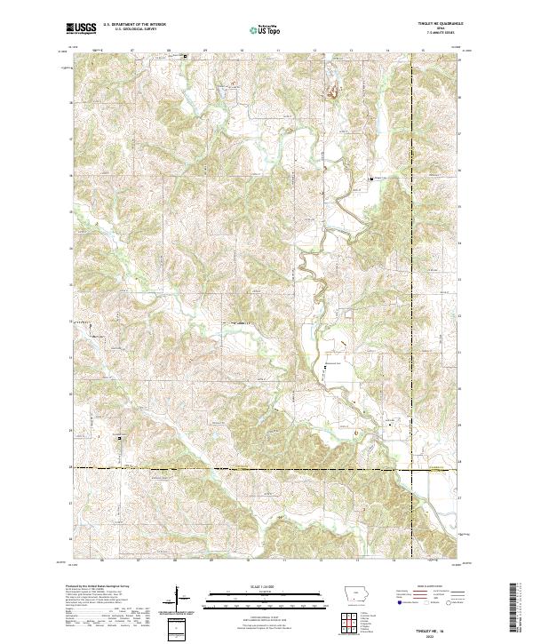
2022 Map of Tingley NE
USGS Topo · Published 2022About this map
Thompson River and its numerous tributaries, including Twelvemile Cr and Sand Cr, define the drainage patterns across this rural landscape at the junction of Union, Clarke, Ringgold, and Decatur counties. This modern topographic study reveals a territory characterized by its agricultural section lines and a network of named roads such as Spring Valley Lake Dr and State Hwy 260. For genealogists and local historians, the map is particularly valuable for its precise location of several rural burial grounds. These include Otterbein Cem in the north, Olinger Cem and Homewood Cem further south, and the Cornwall Cem and Leas Cem near the southern border. The intricate contour lines illustrate the undulating terrain between the river valleys, showing how the land has been subdivided into townships like t71n r28w and t72n r27w.
Find a feature on this map
61 named features on this map. Tap any name to fly to it.
Don’t see what you’re looking for? This feature index may not catch every label — zoom into the map to look around manually.
Map Details
Editions of this 2022 Tingley NE Map
This is the sole edition of this map. No revisions or reprints were ever made.
Other maps of this area

1951 · Osceola
USGS Topo · 1:62,500

1951 · Afton
USGS Topo · 1:62,500

1954 · Centerville
USGS Topo · 1:250,000

1954 · Omaha
USGS Topo · 1:250,000

1954 · Des Moines
USGS Topo · 1:250,000

1955 · Nebraska City
USGS Topo · 1:250,000

1956 · Des Moines
USGS Topo · 1:250,000

1957 · Des Moines
USGS Topo · 1:250,000

1957 · Nebraska City
USGS Topo · 1:250,000

1957 · Omaha
USGS Topo · 1:250,000