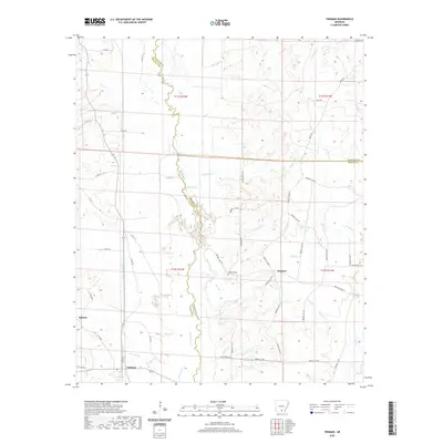
2020 Map of Tinsman
USGS Topo · Published 2020About this map
Moro Creek serves as the winding natural boundary between Calhoun, Cleveland, and Bradley Counties, defining a landscape dominated by intricate drainage systems and low-lying wetlands. In the southwestern corner, the small community of Tinsman is situated near Watson, while the settlement of Wagnon lies further east along a network of rural roads. The area's topography is marked by numerous named tributaries including Big Slough, White Oak Cr, and Irish Bill Cr, which feed into the primary creek system. Local history and family roots are anchored by sites such as the Williams Cem, located near the intersection of several Bradley County routes. The map illustrates a rural Arkansas economy still closely tied to the water and timber of the bottomlands, with Scott Water and Blue Springs providing notable landmarks within the dense network of county roads like Co RD 75 and Bradley Road 10.
Find a feature on this map
70 named features on this map. Tap any name to fly to it.
Don’t see what you’re looking for? This feature index may not catch every label — zoom into the map to look around manually.
Map Details
Editions of this 2020 Tinsman Map
This is the sole edition of this map. No revisions or reprints were ever made.
Other maps of this area

1953 · El Dorado
USGS Topo · 1:250,000

1957 · El Dorado
USGS Topo · 1:250,000

1958 · El Dorado
USGS Topo · 1:250,000

1960 · El Dorado
USGS Topo · 1:250,000

1966 · Kingsland
USGS Topo · 1:24,000

1966 · Fordyce
USGS Topo · 1:24,000

1970 · New Edinburg
USGS Topo · 1:24,000
1973 · Hampton
USGS Topo · 1:24,000
1973 · Mc Kinney
USGS Topo · 1:24,000
1973 · Farmville
USGS Topo · 1:24,000