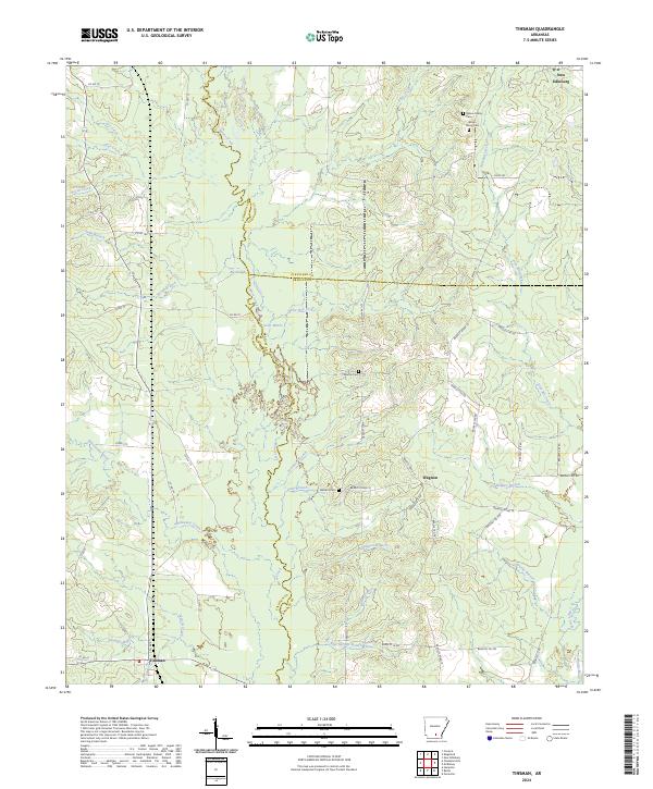
2024 Map of Tinsman
USGS Topo · Published 2024About this map
Moro Creek serves as a natural dividing line in this timber-rich region of South Arkansas, marking the boundary between Calhoun, Cleveland, and Bradley counties. The settlement of Tinsman anchors the southwestern corner of the sheet, while the northern edge touches the outskirts of New Edinburg. The landscape is defined by an intricate network of waterways, including Big Slough, Irish Bill Creek, and L'Aigle Creek, which carve through the dense woodlands. For genealogists, the map reveals specific local burial sites such as the Wilson Family Cem, Denton Cem, and Williams Cem, providing precise locations for family history research. Small rural crossroads like Wagnon and landmarks such as Blue Springs illustrate the dispersed nature of human settlement in this river-and-creek-fed terrain, where local travel relies on an extensive system of county and forest roads.
Find a feature on this map
68 named features on this map. Tap any name to fly to it.
Don’t see what you’re looking for? This feature index may not catch every label — zoom into the map to look around manually.
Map Details
Editions of this 2024 Tinsman Map
This is the sole edition of this map. No revisions or reprints were ever made.
Other maps of this area

1953 · El Dorado
USGS Topo · 1:250,000

1957 · El Dorado
USGS Topo · 1:250,000

1958 · El Dorado
USGS Topo · 1:250,000

1960 · El Dorado
USGS Topo · 1:250,000

1966 · Kingsland
USGS Topo · 1:24,000

1966 · Fordyce
USGS Topo · 1:24,000

1970 · New Edinburg
USGS Topo · 1:24,000
1973 · Hampton
USGS Topo · 1:24,000
1973 · Mc Kinney
USGS Topo · 1:24,000
1973 · Farmville
USGS Topo · 1:24,000