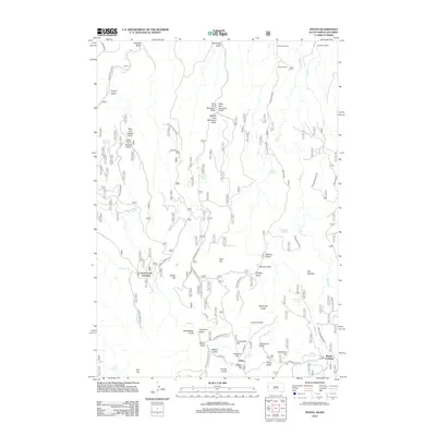
2012 Map of Tinton
USGS Topo · Published 2012About this map
Tinton and Beaver Crossing anchor this high-elevation landscape on the South Dakota-Wyoming border, where the terrain is defined by a complex network of ridges and drainages. The area is marked by a deep ranching history, evidenced by Ranch A, C Nicholas Ranch, and the Miller Ranch. The mapping reveals a rugged system of forestry and access roads like Beaver Creek Rd and Boundary Gulch Rd that navigate the slopes of Grandview Hill and Sunshine Hill. A significant concentration of springs, including Knight Spring, Thompson Spring, and Nelson Spring, suggests the vital role of water management in this arid mountain environment. Local landmarks such as The Needles and the isolated Bear Gulch Cem provide specific points of interest for genealogists and researchers tracking the settlement patterns of Lawrence County and the surrounding Black Hills region.
Find a feature on this map
66 named features on this map. Tap any name to fly to it.
Don’t see what you’re looking for? This feature index may not catch every label — zoom into the map to look around manually.
Map Details
Editions of this 2012 Tinton Map
This is the sole edition of this map. No revisions or reprints were ever made.
Other maps of this area

1894 · Deadwood
USGS Topo · 1:125,000

1898 · Sundance
USGS Topo · 1:125,000

1900 · Spearfish
USGS Topo · 1:62,500

1901 · Deadwood
USGS Topo · 1:125,000

1901 · Aladdin
USGS Topo · 1:125,000

1902 · Sundance
USGS Topo · 1:125,000

1903 · Aladdin
USGS Topo · 1:125,000

1907 · Belle Fourche
USGS Topo · 1:125,000

1907 · Redwater
USGS Topo · 1:62,500

1915 · Spearfish
USGS Topo · 1:62,500