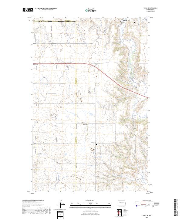
2024 Map of Tioga SE
USGS Topo · Published 2024About this map
The White Earth River meanders through the eastern portion of this landscape, carving a valley across the border of Williams and Mountrail counties. This modern topographic study reveals a rural region defined by its sections and township lines, where small family and community landmarks remain central to the local geography. Significant genealogical sites are concentrated in the northern reach, including the Saint Francis Catholic Cem and the nearby White Earth Cem, which sit just north of the river's bend.
Find a feature on this map
35 named features on this map. Tap any name to fly to it.
Don’t see what you’re looking for? This feature index may not catch every label — zoom into the map to look around manually.
Map Details
Editions of this 2024 Tioga SE Map
This is the sole edition of this map. No revisions or reprints were ever made.
Other maps of this area

1953 · Williston
USGS Topo · 1:250,000

1957 · Williston
USGS Topo · 1:250,000

1965 · Charlson NE
USGS Topo · 1:24,000

1965 · Charlson NW
USGS Topo · 1:24,000

1969 · Ross NW
USGS Topo · 1:24,000

1969 · White Earth
USGS Topo · 1:24,000

1979 · Tioga SE
USGS Topo · 1:24,000
1979 · Tioga SW
USGS Topo · 1:24,000
1979 · Tioga
USGS Topo · 1:24,000

1981 · Manitou
USGS Topo · 1:24,000