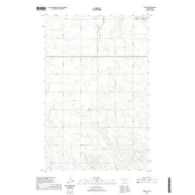
2020 Map of Tioga SW
USGS Topo · Published 2020About this map
Trinity Lutheran Cem and Bethany Cem stand as quiet landmarks within the sprawling section lines of Williams County, reflecting the deep-rooted agricultural and spiritual heritage of the North Dakota plains. The landscape is defined by the expansive grid of range roads, including 104th Ave NW and 106th Ave NW, which partition the prairie into large-scale farming tracts. To the northeast, the Tioga Municipal Airport marks the transition toward the regional center of Tioga, while the intermittent drainage of Dry Fork Cr provides the primary topographic variation in an otherwise rhythmic terrain. The map also captures the administrative divide between Mountrail and Williams counties, illustrating how modern political boundaries and transportation networks like Co Hwy 23 continue to follow the historical Public Land Survey System established during settlement.
Find a feature on this map
29 named features on this map. Tap any name to fly to it.
Don’t see what you’re looking for? This feature index may not catch every label — zoom into the map to look around manually.
Map Details
Editions of this 2020 Tioga SW Map
This is the sole edition of this map. No revisions or reprints were ever made.
Other maps of this area

1911 · Ray
USGS Topo · 1:125,000

1953 · Williston
USGS Topo · 1:250,000

1957 · Williston
USGS Topo · 1:250,000

1965 · Charlson NE
USGS Topo · 1:24,000

1965 · Charlson NW
USGS Topo · 1:24,000

1969 · White Earth
USGS Topo · 1:24,000

1969 · Red Mike Hill
USGS Topo · 1:24,000

1978 · Ray SE
USGS Topo · 1:24,000

1978 · Temple
USGS Topo · 1:24,000

1979 · Tioga SE
USGS Topo · 1:24,000