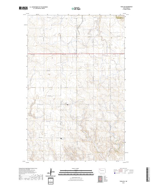
2024 Map of Tioga SW
USGS Topo · Published 2024About this map
Trinity Lutheran Cem and Bethany Cem stand as quiet markers of the local farming community within this Williams County landscape. The terrain is defined by the winding course of Dry Fork Creek in the southeastern corner, which carves through the undulating prairie. A systematic network of section lines and rural routes, including Co Hwy 23 and 66th St NW, organizes the land into the traditional township and range blocks characteristic of the northern plains. This map illustrates the contemporary rural layout of the region, where the vast open spaces are punctuated by these historic burial grounds and a strictly gridded road system designed for agricultural access. The area remains primarily defined by its drainage patterns and the enduring township boundaries of T157N through T155N.
Find a feature on this map
30 named features on this map. Tap any name to fly to it.
Don’t see what you’re looking for? This feature index may not catch every label — zoom into the map to look around manually.
Map Details
Editions of this 2024 Tioga SW Map
This is the sole edition of this map. No revisions or reprints were ever made.
Other maps of this area

1911 · Ray
USGS Topo · 1:125,000

1953 · Williston
USGS Topo · 1:250,000

1957 · Williston
USGS Topo · 1:250,000

1965 · Charlson NE
USGS Topo · 1:24,000

1965 · Charlson NW
USGS Topo · 1:24,000

1969 · White Earth
USGS Topo · 1:24,000

1969 · Red Mike Hill
USGS Topo · 1:24,000

1978 · Ray SE
USGS Topo · 1:24,000

1978 · Temple
USGS Topo · 1:24,000

1979 · Tioga SE
USGS Topo · 1:24,000