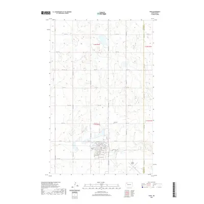
2020 Map of Tioga
USGS Topo · Published 2020About this map
Tioga serves as the primary hub of this North Dakota landscape, situated at the intersection of Co Hwy 10 and 104th Ave NW. The town's grid is meticulously detailed, showing the layout from 1st St SE up to 5th St NW, reflecting the community's established core and residential growth. This survey captures a moment in the region's modern history, where the local economy and infrastructure are anchored by the Tioga Municipal Airport to the southeast. Family and local history researchers will find significant value in the concentration of burial grounds surrounding the town, including Bakken Cem, Eastside Cem, Hillside Cem, and United Cem. The terrain is marked by the boundary between Williams Co and Mountrail Co, with a dense network of section-line roads like 74th St NW and 107th Ave NW defining the agricultural character of the surrounding plains.
Find a feature on this map
40 named features on this map. Tap any name to fly to it.
Don’t see what you’re looking for? This feature index may not catch every label — zoom into the map to look around manually.
Map Details
Editions of this 2020 Tioga Map
This is the sole edition of this map. No revisions or reprints were ever made.
Other maps of this area

1911 · Ray
USGS Topo · 1:125,000

1953 · Williston
USGS Topo · 1:250,000

1957 · Williston
USGS Topo · 1:250,000

1969 · White Earth
USGS Topo · 1:24,000

1974 · McGregor
USGS Topo · 1:24,000

1974 · Big Meadow
USGS Topo · 1:24,000

1978 · Battleview
USGS Topo · 1:24,000

1978 · Ray SE
USGS Topo · 1:24,000

1978 · Temple
USGS Topo · 1:24,000

1979 · Tioga SE
USGS Topo · 1:24,000