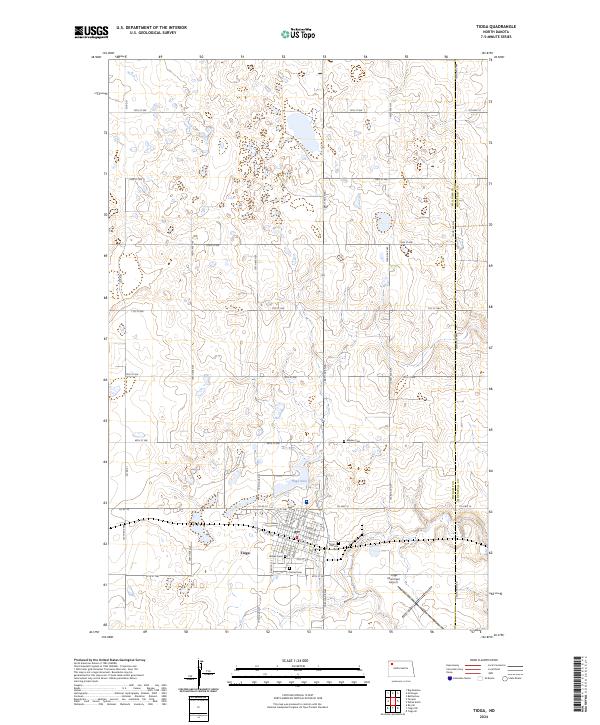
2024 Map of Tioga
USGS Topo · Published 2024About this map
Tioga serves as the focal point of this northwestern North Dakota landscape, situated at the boundary of Williams and Mountrail Counties. The town's grid is meticulously detailed, showing a concentration of community landmarks including Hillside Cem, United Cem, and Eastside Cem. To the north, the terrain is defined by the Tioga Dam and the sprawling Williams County Waterfowl Production Area, which reflects the region's managed prairie wetlands. The map illustrates a transitional landscape where established settlement meets the industrial infrastructure of the Williston Basin, evidenced by the proximity of the Tioga Municipal Airport and a dense network of section-line roads like 105th Ave NW and 69th St NW. Farther afield, the Bakken Cem stands as a solitary marker in the northern townships, highlighting the deep-rooted family history of this high-plains agricultural community.
Find a feature on this map
41 named features on this map. Tap any name to fly to it.
Don’t see what you’re looking for? This feature index may not catch every label — zoom into the map to look around manually.
Map Details
Editions of this 2024 Tioga Map
This is the sole edition of this map. No revisions or reprints were ever made.
Other maps of this area

1911 · Ray
USGS Topo · 1:125,000

1953 · Williston
USGS Topo · 1:250,000

1957 · Williston
USGS Topo · 1:250,000

1969 · White Earth
USGS Topo · 1:24,000

1974 · McGregor
USGS Topo · 1:24,000

1974 · Big Meadow
USGS Topo · 1:24,000

1978 · Battleview
USGS Topo · 1:24,000

1978 · Ray SE
USGS Topo · 1:24,000

1978 · Temple
USGS Topo · 1:24,000

1979 · Tioga SE
USGS Topo · 1:24,000