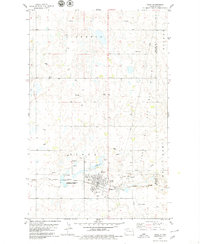
1979 Map of Tioga
USGS Topo · Published 1979About this map
Tioga serves as the industrial and social anchor of this prairie landscape, where the energy economy and agricultural heritage meet. The town is marked by its essential infrastructure, including a High Sch, Hospital, and several community religious sites such as Hillside Cem, Eastside Cem, and United Cem. To the east, the Gas Processing Plant and numerous Oil Wells scattered across the Tioga and Oil Field signal the region's mid-century petroleum development.
Find a feature on this map
25 named features on this map. Tap any name to fly to it.
Don’t see what you’re looking for? This feature index may not catch every label — zoom into the map to look around manually.
Map Details
Editions of this 1979 Tioga Map
This is the sole edition of this map. No revisions or reprints were ever made.
Other maps of this area
1911 · Ray
USGS Topo · 1:125,000
1953 · Williston
USGS Topo · 1:250,000
1957 · Williston
USGS Topo · 1:250,000
1969 · White Earth
USGS Topo · 1:24,000
1974 · McGregor
USGS Topo · 1:24,000
1974 · Big Meadow
USGS Topo · 1:24,000
1978 · Battleview
USGS Topo · 1:24,000
1978 · Ray SE
USGS Topo · 1:24,000
1978 · Temple
USGS Topo · 1:24,000
1979 · Tioga SE
USGS Topo · 1:24,000