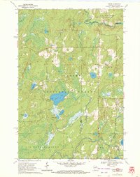
1970 Map of Tipler
USGS Topo · Published 1972About this map
Tipler serves as a small gateway to the dense woodlands of the Nicolet National Forest during the early 1970s. The landscape is defined by its complex hydrology, with the Brule River forming the northern border between Wisconsin and Michigan, while the Popple River and Pine River wind through the southern sections. This area was a hub for outdoor recreation and local heritage, evidenced by the Stevens Lake Campground and the Martin Cem.
Find a feature on this map
39 named features on this map. Tap any name to fly to it.
Don’t see what you’re looking for? This feature index may not catch every label — zoom into the map to look around manually.
Map Details
Editions of this 1970 Tipler Map
2 editions found
Other maps of this area

1898 · Iron River
USGS Topo · 1:62,500

1938 · Alvin
USGS Topo · 1:48,000

1939 · Long Lake
USGS Topo · 1:48,000

1944 · Iron River
USGS Topo · 1:24,000

1944 · Gaastra
USGS Topo · 1:24,000

1946 · Iron River
USGS Topo · 1:31,680

1946 · Gaastra
USGS Topo · 1:31,680

1946 · Alvin
USGS Topo · 1:48,000

1948 · Long Lake
USGS Topo · 1:48,000

1954 · Iron Mountain
USGS Topo · 1:250,000