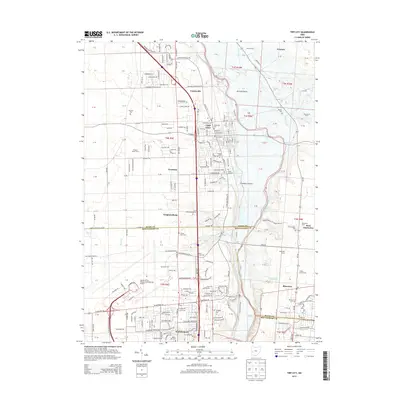
2013 Map of Tipp City
USGS Topo · Published 2013About this map
The Great Miami River valley defines the character of this landscape between Tipp City and Vandalia. This modern topographic survey shows the extensive development of the James M Cox Dayton International Airport in the southwest corner, contrasting with the agricultural tradition of Gerard Prairie and Freemans Prairie to the east. The map records a dense network of local cemeteries that anchor the history of the Miami Valley, including Hyattsville Cem, Maple Hill Cem, and the Saint Johns Cem. Along the river corridor, the terrain transitions from the upland plains near Ginghamburg to the riparian bottoms of Lost Creek and Honey Creek. Smaller communities like Phoneton and West Charleston remain legible on the landscape, providing essential points of reference for genealogists tracking family history in the borderlands of Miami and Montgomery counties.
Find a feature on this map
191 named features on this map. Tap any name to fly to it.
Don’t see what you’re looking for? This feature index may not catch every label — zoom into the map to look around manually.
Map Details
Editions of this 2013 Tipp City Map
This is the sole edition of this map. No revisions or reprints were ever made.
Other maps of this area

1904 · Dayton
USGS Topo · 1:62,500

1905 · Brookville
USGS Topo · 1:62,500

1906 · Dayton
USGS Topo · 1:62,500

1911 · Covington
USGS Topo · 1:62,500

1914 · Troy
USGS Topo · 1:62,500

1944 · Covington
USGS Topo · 1:62,500

1944 · Troy
USGS Topo · 1:62,500

1953 · Cincinnati
USGS Topo · 1:250,000

1953 · Muncie
USGS Topo · 1:250,000

1955 · West Milton
USGS Topo · 1:24,000